
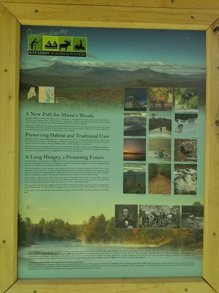
Weekend Adventure
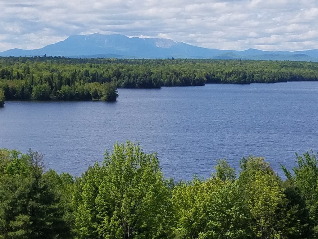
Treben and I decided it would be fun to take a trip up to the new Katahdin Woods & Waters National Monument and see what the park has to offer. In short, this place offers incredible views, lots of outdoor recreation opportunities, high potential for wildlife viewing and is definitely worth the trip! On our way up, we decided to stop at the scenic overlook on I-95 and catch a view of Mt. Katahdin in the distance.
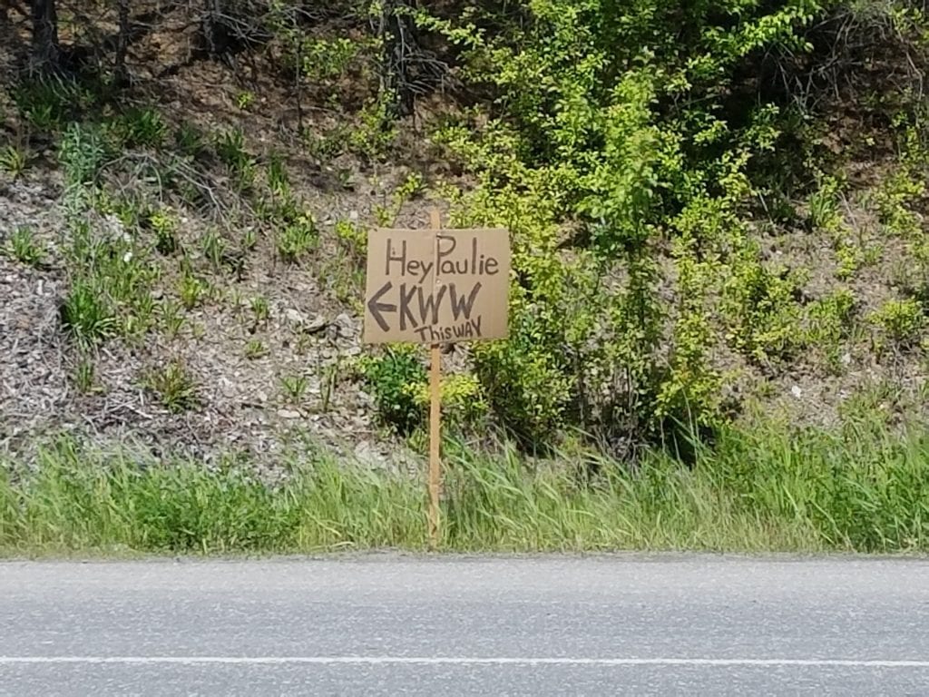
Off to a rough start
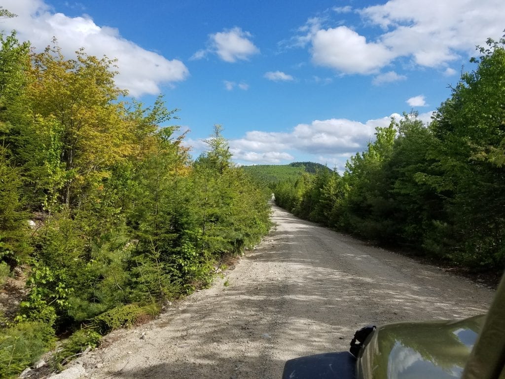
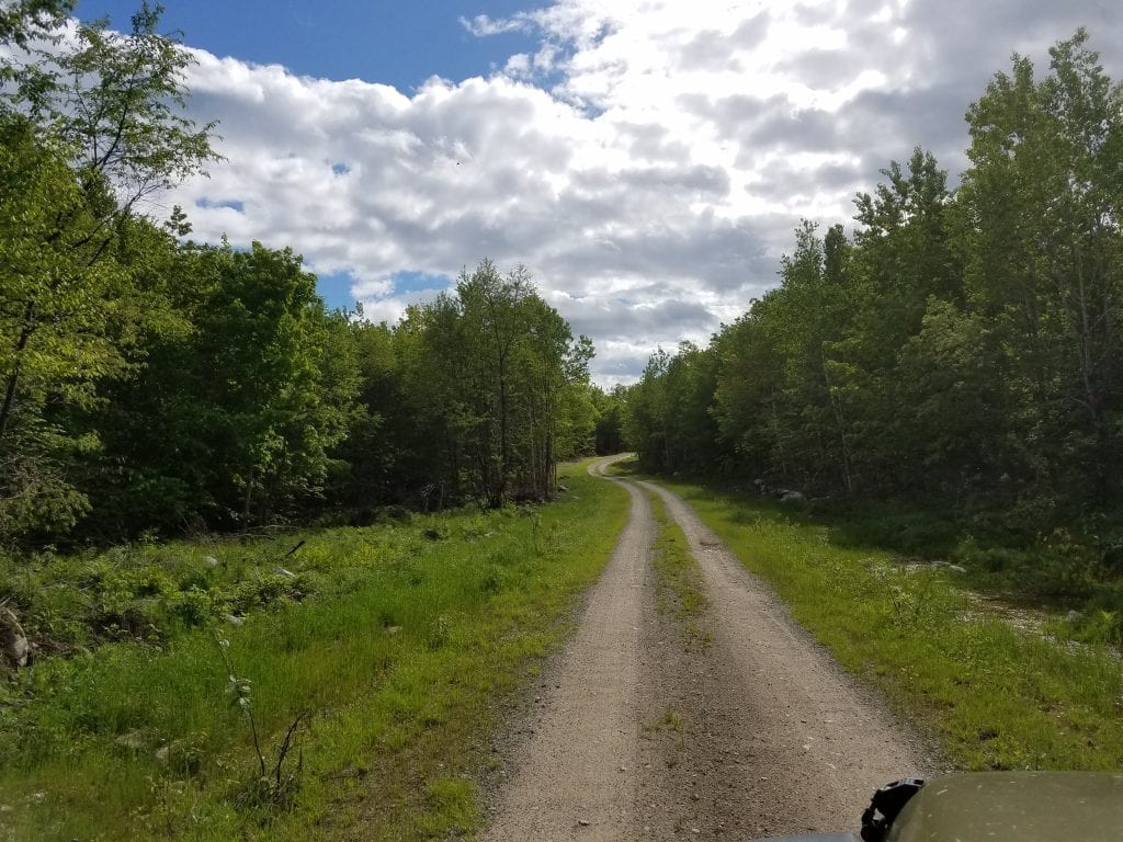
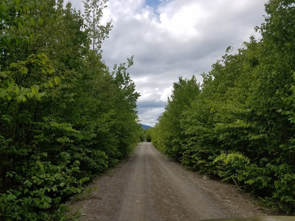
Unfortunately, our journey was off to a rough start, as we drove the wrong way on Route 11 and ended up Sherman Station. Hopefully Paulie didn’t do the same. I think I need to teach my co-pilot some map skills, asap! We drove in through the Sherman Lumber Company Road, which was long and rough. The road will definitely get you where you want to go, but I recommend heading in through Swift Brook Road in Stacyville. The road is best traveled in a truck, SUV, or high-clearance vehicle because of the pot holes. Definitely make sure you have a spare tire, tire iron, jack, and maybe even a flat repair kit and air pump. If the roads have recently been graded there is a pretty high risk that you could end up with a flat. Also stay to the right of the road as much as you can, and pull over when you see a logging truck coming up behind you and let them go by. Logging truck drivers know these roads like the back of their hand.
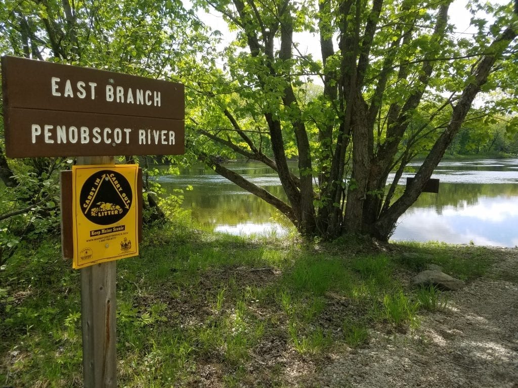
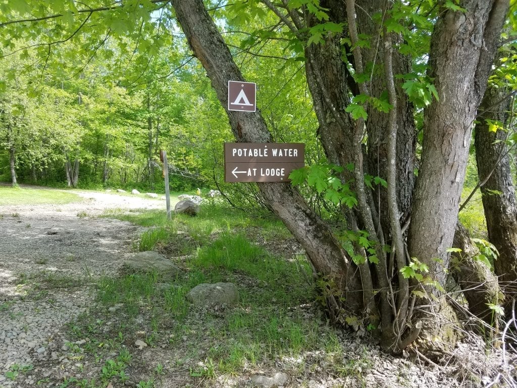
It’s not always bad to go the wrong way
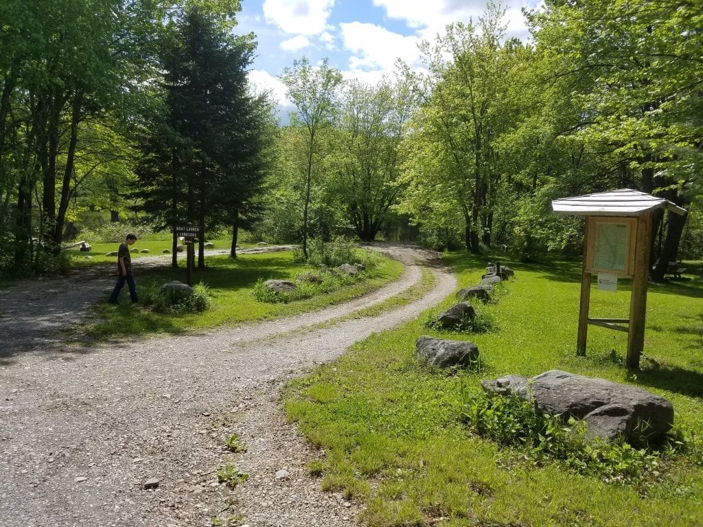
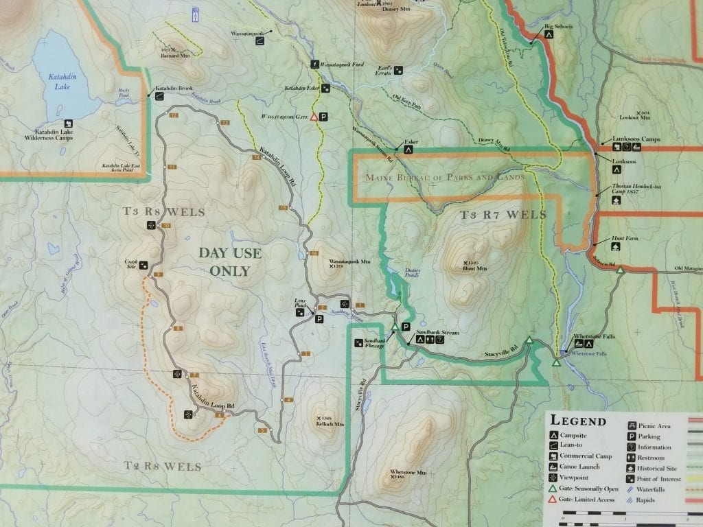
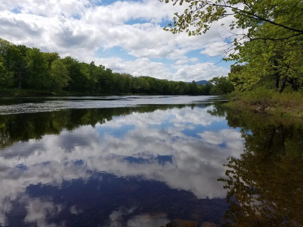
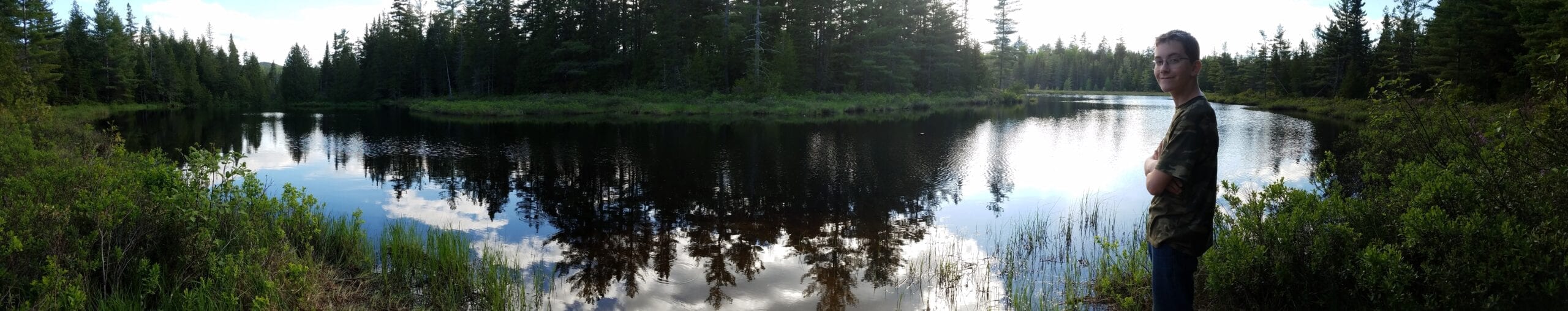
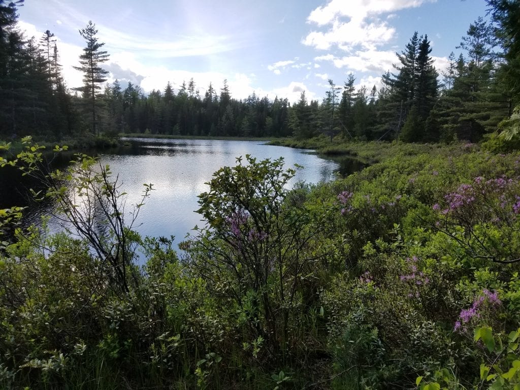
As Treben and I found out, going the wrong way had its advantages. We got to drive through two other sections of KWW and stopped at the Lunksoos campsite. There is a map of the park on display there, and a boat launch on the bank of the East Branch Penobscot River. Across the road is a lodge which has potable water and is part of the park. We didn’t head over to check it out, and I’m not sure if it’s manned at the moment. This is a great location to put a canoe or kayak in the water and check out the river, go swimming or fishing.
Follow the signs
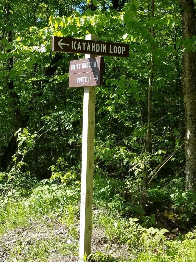
If you head in through the Swift Brook Road in Stacyville you will find a sign pointing you in the right direction of the park at a fork in the road. Stay to the left at the fork, as the sign recommends. Going right (straight) will take you to the Seboeis Road, which is the way we came in, and the way to get to Lunksoos Camps.
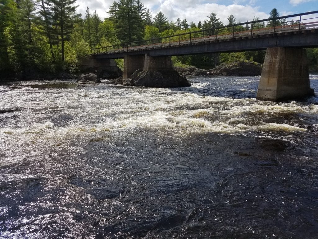
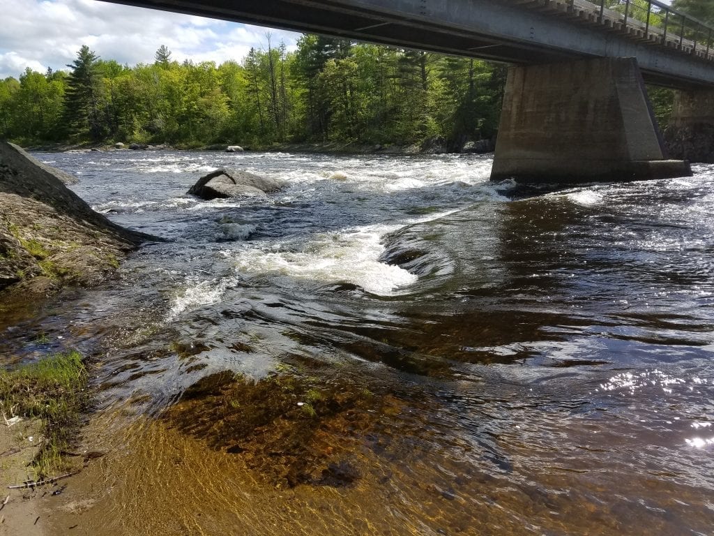
Whitestone Falls
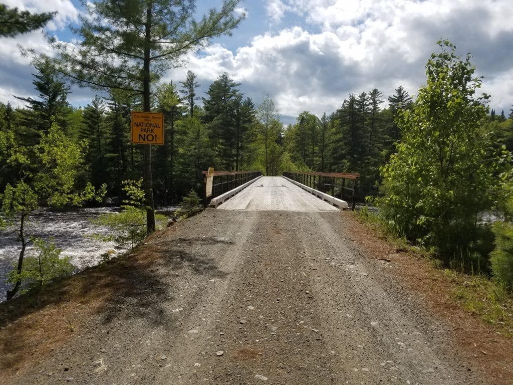
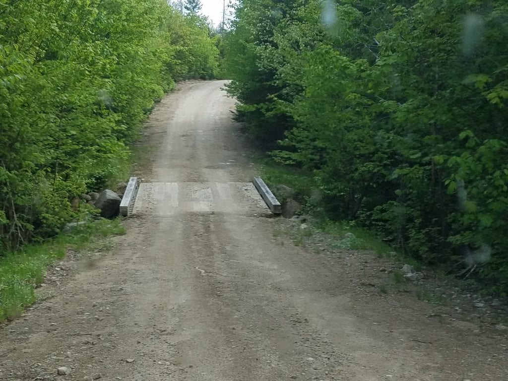
Just before reaching the largest section of the park you will cross a bridge that spans the East Branch Penobscot River near Whitestone Falls. This is a fantastic photo opportunity and is incredibly beautiful. Again, keep in mind that this is a logging road. Don’t walk on the bridge- logging trucks don’t slow down for much and they’re trying to work. You can get great photos from the bank of the river.
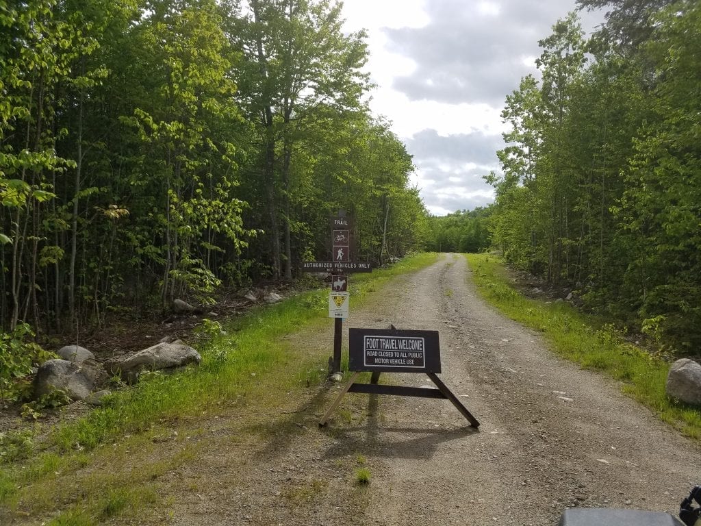
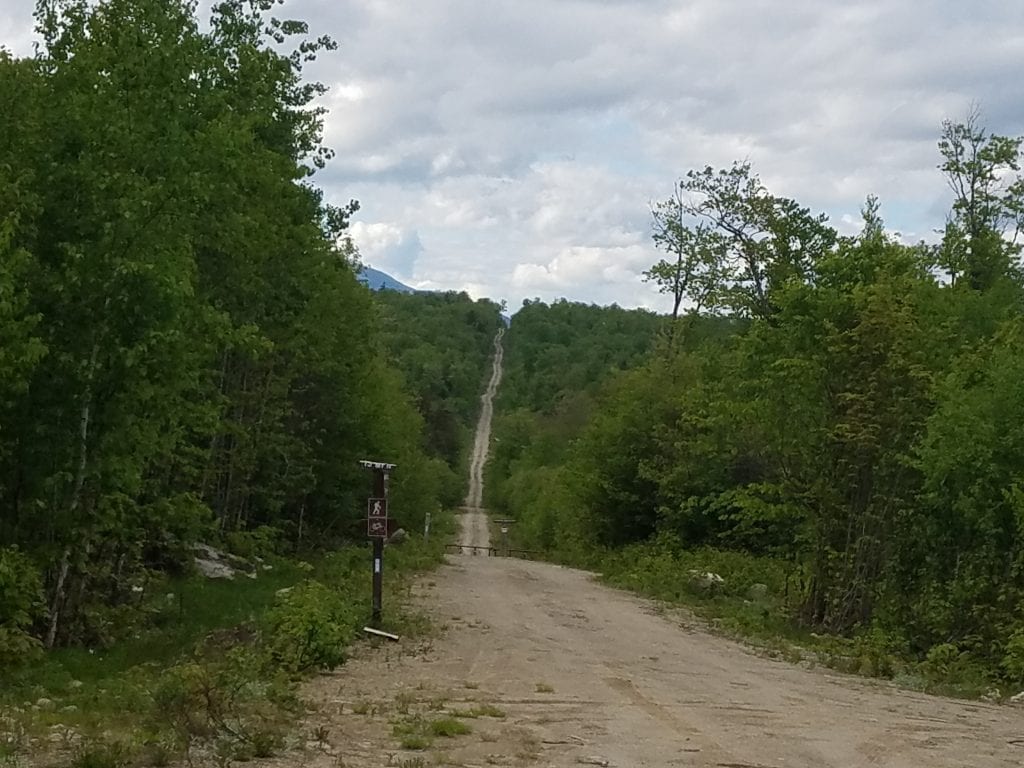
Welcome to Katahdin Woods & Waters National Monument
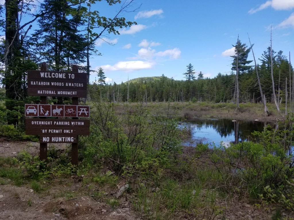
The entrance to the park has an incredible view- the photo doesn’t do it justice. There is a scenic lookout that you can hike, but only about enough space for two cars to park at the moment. There wasn’t a sign that told us how long the hike was for the scenic lookout, so we didn’t check it out. You will cross a small stream full of trout just before reaching the gate entrance.
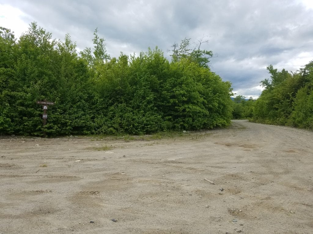
Katahdin Loop Road
The Katahdin Loop Road is between 15-16 miles long, and the speed limit there is 15 mph. Stick to the speed limit, as traffic can go either way, the road is quite narrow, and wildlife could be around any corner. As of right now, there are lots of places where limbs are hanging in the road, so if you love your paint job, you might want to take a different vehicle. The road has varied terrain, as it is still a work in progress. There is one section of the road that goes up hill and has some loose gravel. Drive the speed limit and you should be all set. Mile markers show you where you are, and signs show you where the scenic lookouts are. Many side roads are closed off from the loop road and are now hiking trails.
Katahdin Loop Road Trails
There are many hiking trails along the loop road. The number of parking spaces varies greatly within the park while it is being built. Most don’t have signs that tell you the name of the trail, or trail distances. The signage is limited as well, although it does give you access information. We didn’t have a lot of time available when we visited the park, so we didn’t check out any of the trails.
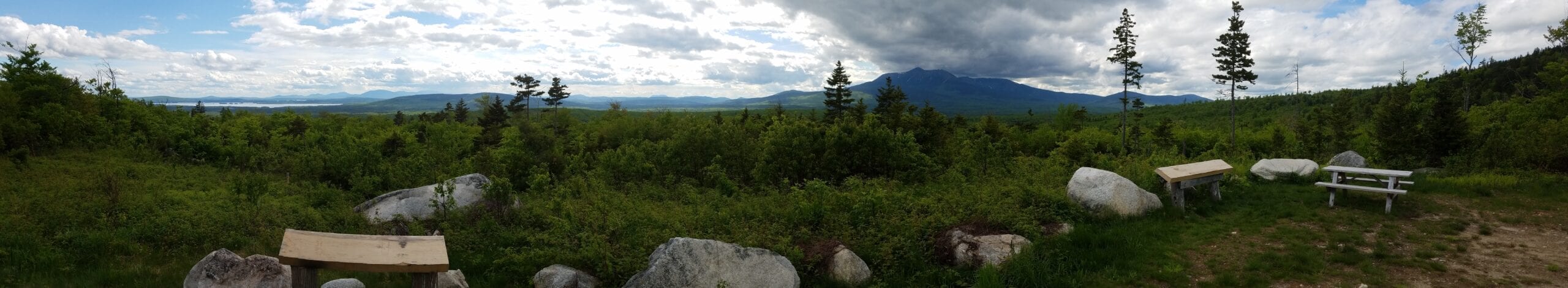
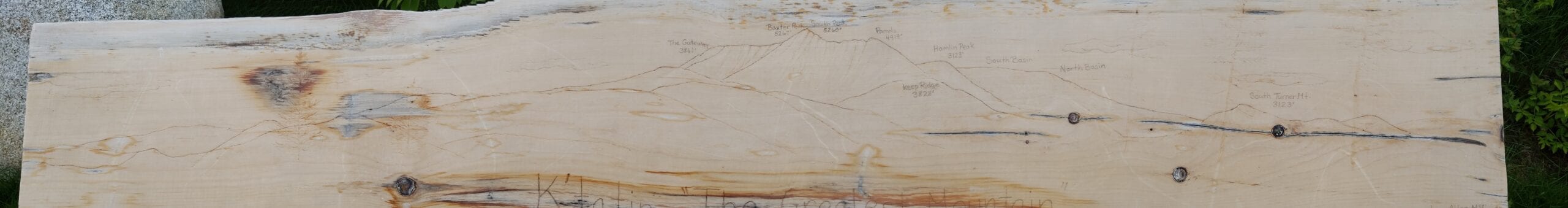
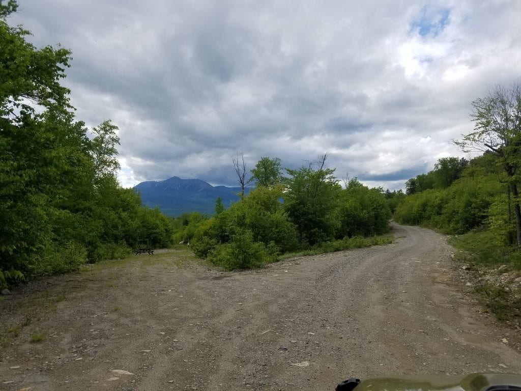
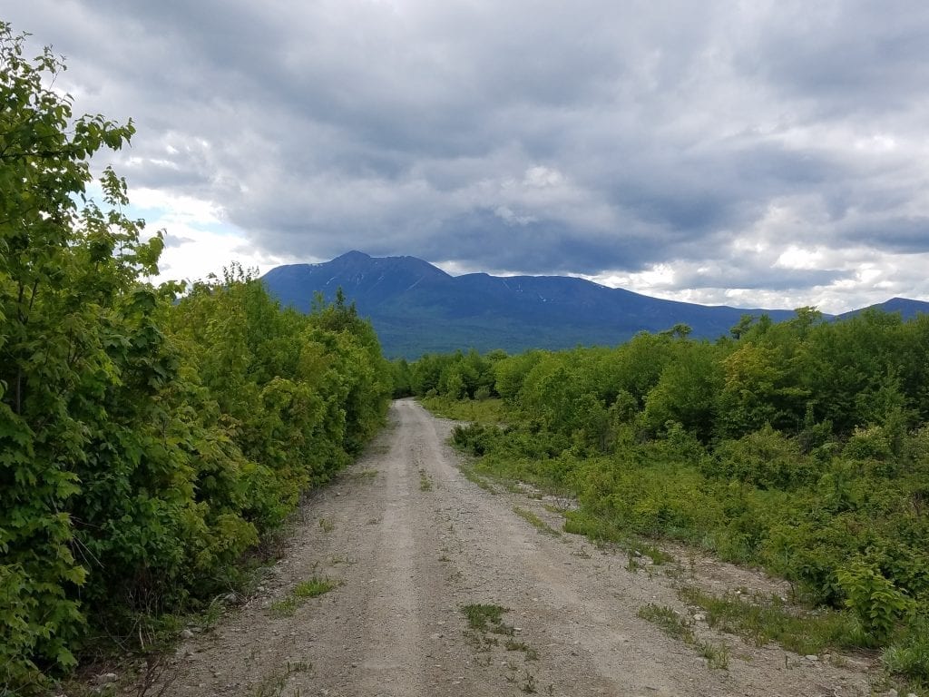
THE Scenic Overlook
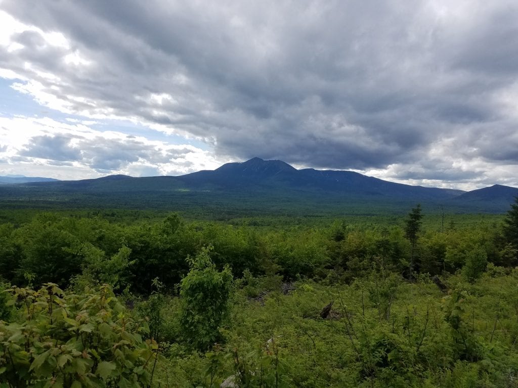
When you see the fork in the road above with the sign that reads Scenic Overlook, go there! It’s just a short drive to a wide-open space with many parking spaces and a million-dollar view of Mount Katahdin and the surrounding region. There are picnic tables, facilities, and hand-carved maps interpreting the incredible view before you. Millinocket Lake is to the far left of the view, and Mount Katahdin is right in front of you. Again, the pictures don’t do it justice. This won’t be the last time you see Mt. Katahdin. As you follow the loop road it will keep coming into view at different points along the journey.
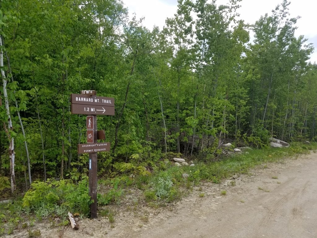
Barnard Mountain Trail
At mile marker 12 you’ll find the trailhead to Barnard Mountain, which is clearly marked. The trail is 1.2 miles long and is the new starting point for the International Appalachian Trail (for now). This trail will also take you to Orin Falls which is beyond Barnard Mountain. Orin Falls can also be reached from the Deasey Mountain Trail. This was the only trail that we found that had a name and distance.
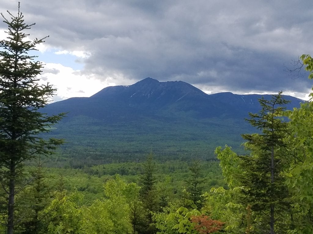
Continuing on the Loop Road
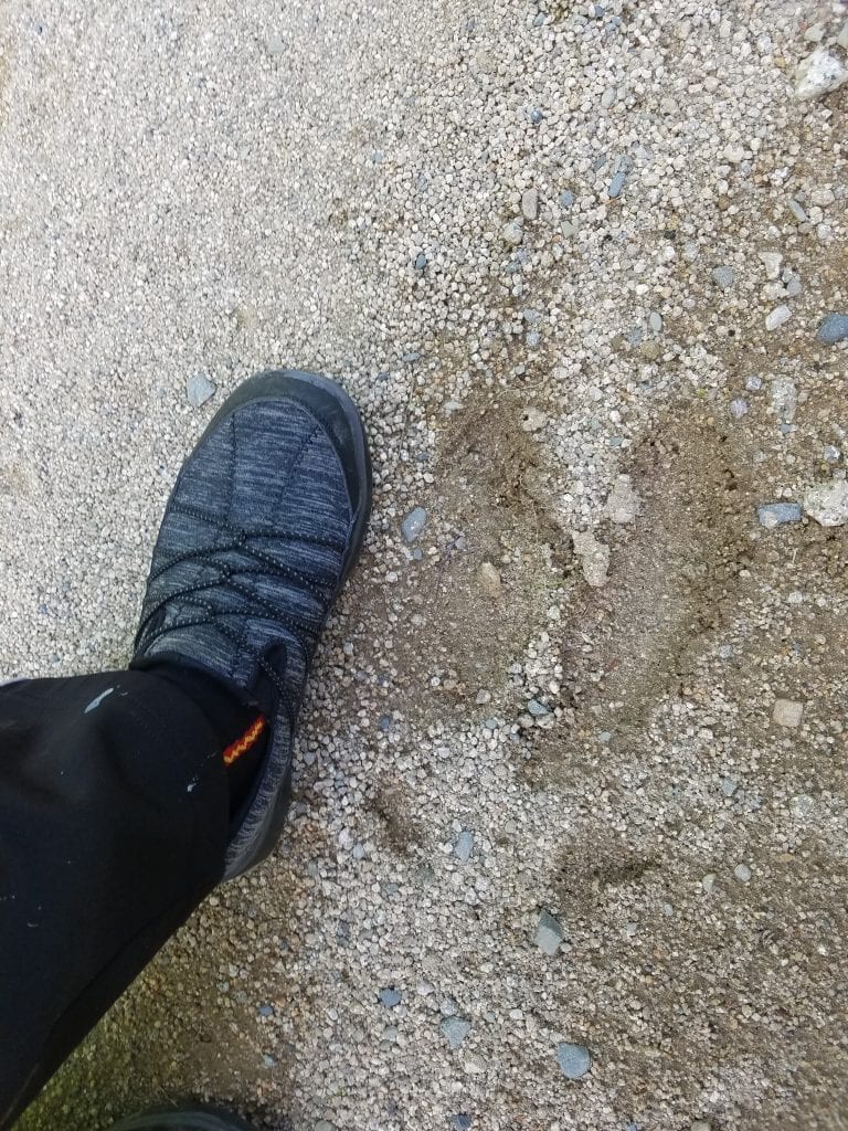
Katahdin comes into view several times after passing the scenic overlook. Keep your eyes open for moose along the road as well, especially from mile marker 12 and on, which is where we saw the most moose poop in the road and some tracks. BIG tracks!
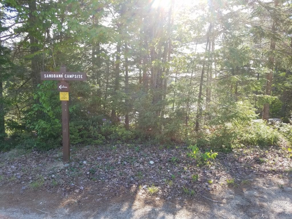
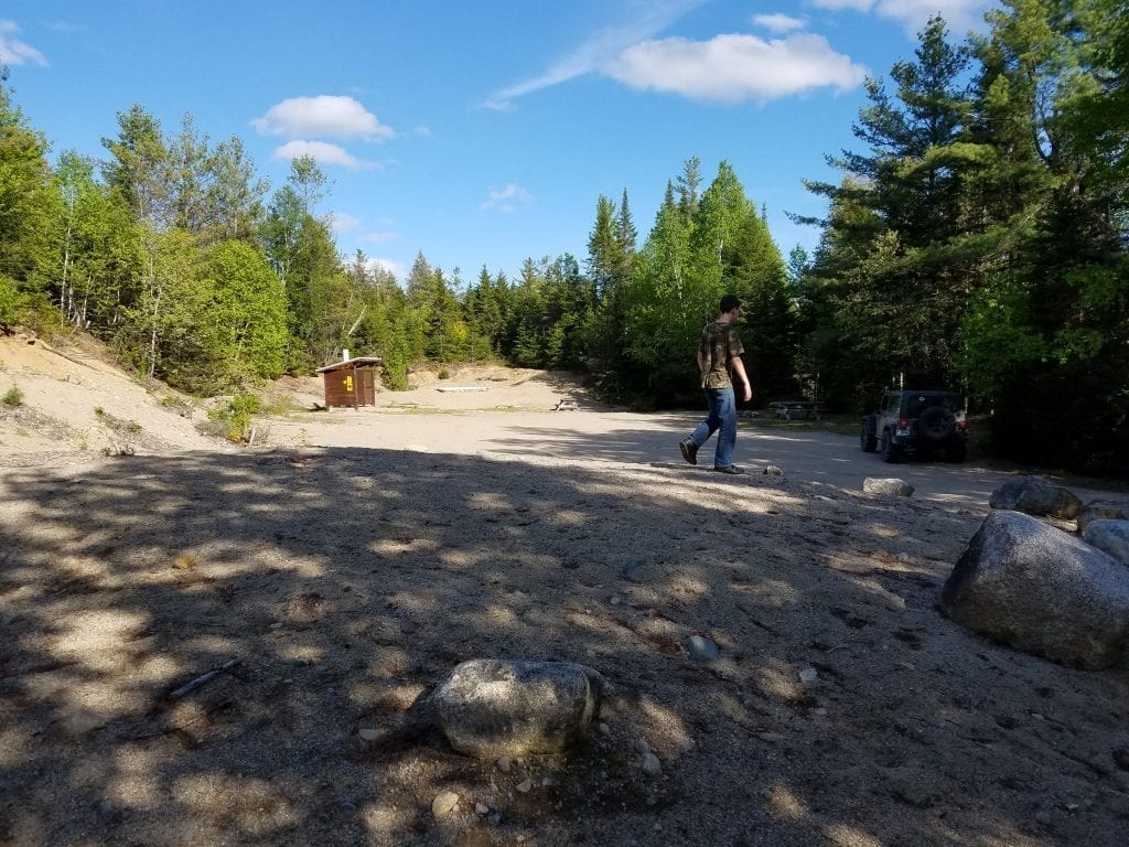
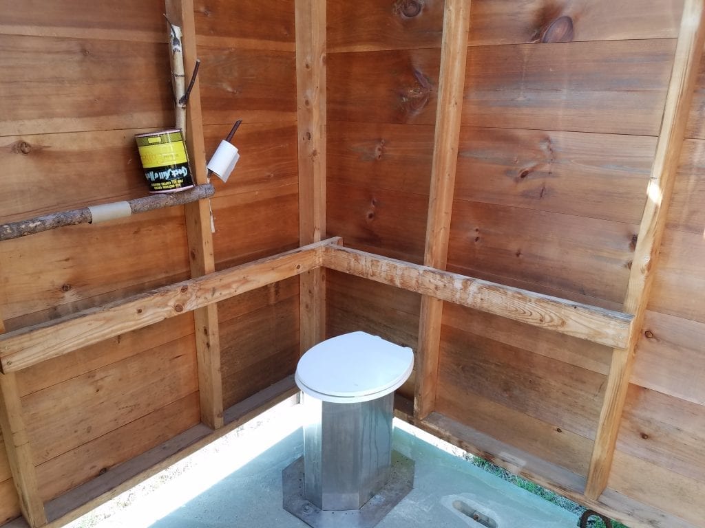
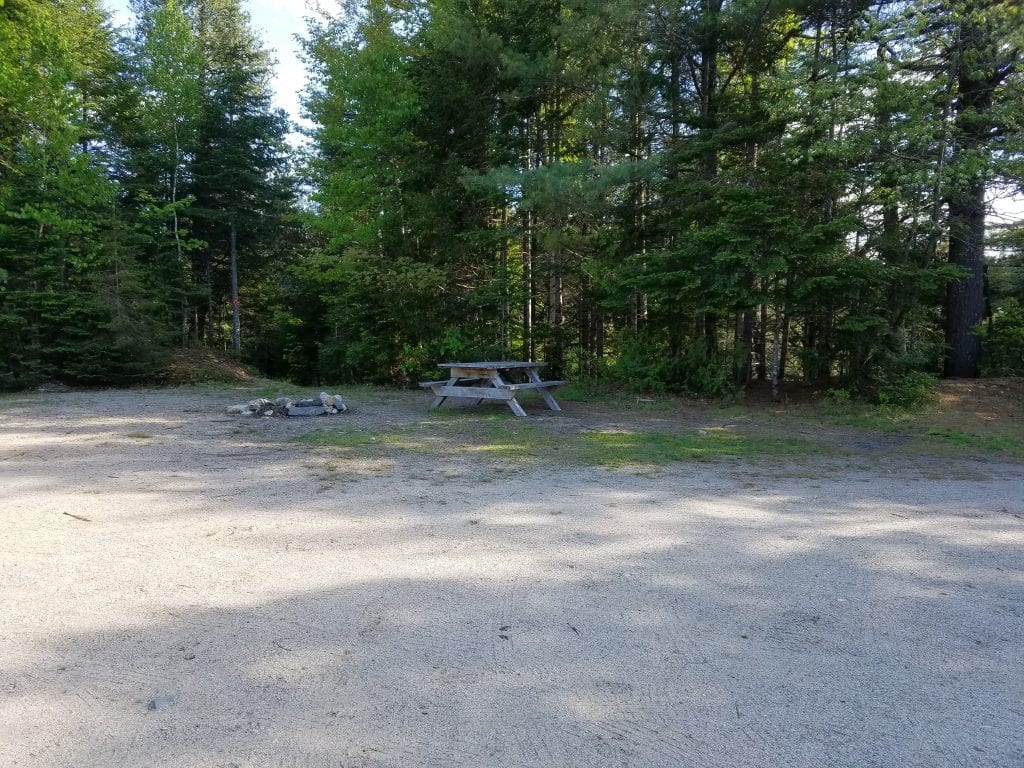
Sandbank Campsite
After finishing the Katahdin Loop Road we stopped at Sandbank Campsite on our way out of the park. This is also a nice spot right next to Sandbank Stream. The site has facilities and water access, with another great view. There are also picnic tables and fire pits at the site. Treben and I also saw moose tracks here near the shore, so you may even get to see some moose while you’re there.
Worth the Trip
Our first visit to Katahdin Woods & Waters National Monument was definitely a great one. We are planning to go back again when we have more time and stay a few days. There are lots of trails on the south end of the park we want to explore, including Barnard Mountain, Orin Falls and Deasey Mountain, which is the highest point in the park and has a fire tower at the top. Another time we plan to head into the park through the north entrance and follow Messer Pond Road (River Road). The northern trails follow the East Branch Penobscot River and pass by Stair Falls, Haskell Rock Pitch, and Grand Pitch. There are so many beautiful places to explore in this region, and I can’t wait to see them all!
Until next time, enjoy Maine’s great outdoors and Stay Untamed!
Thank you! I feel more confident to find my way to the Katahdin Loop Road Overloook. This was the only idetailed information that I could find.