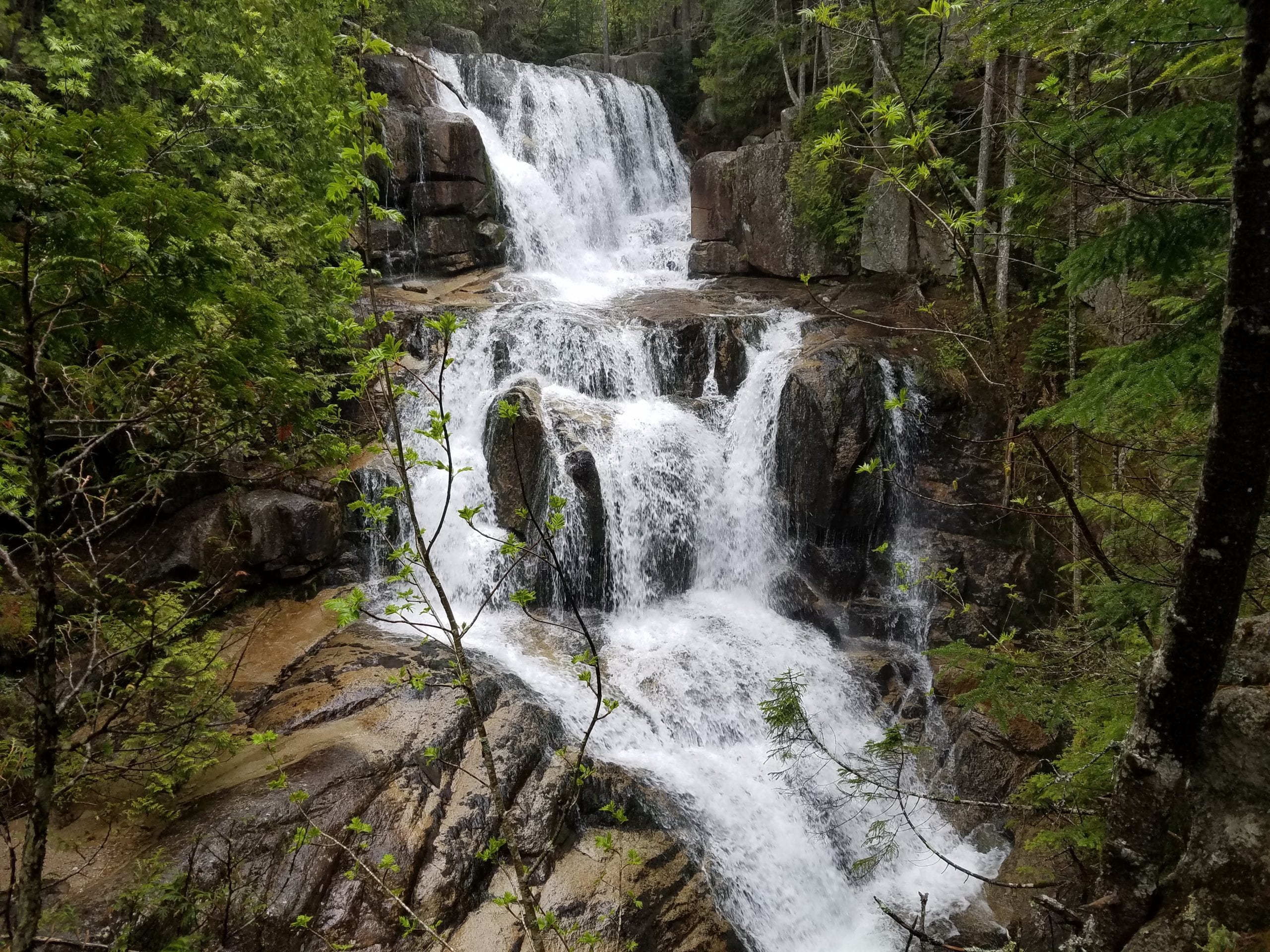
Awesome Falls
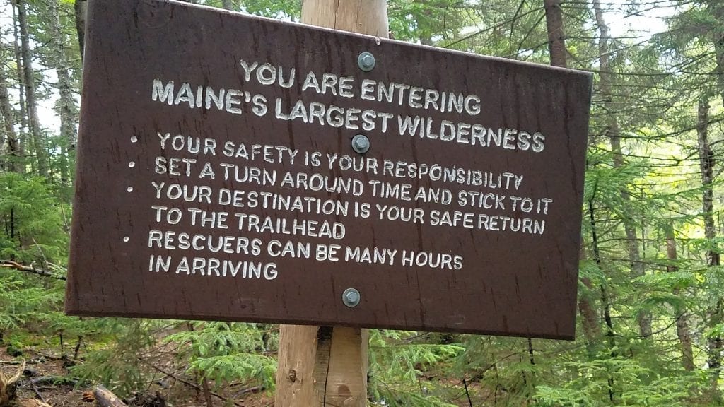
My weekend adventure brought me to Katahdin Stream Falls in Baxter State Park. These falls are a relatively easy hike, and well worth your time when you’re visiting the park. The trailhead for this hike is at Katahdin Stream Campground, which is popular for hikers climbing to the summit of Mount Katahdin. The trail has a lot of foot traffic but will lead you through incredibly beautiful, protected remote wilderness. Click here to watch the video of my Katahdin Stream Falls adventure at the bottom of this post!
Quick & Dirty
DeLorme Map: 50, D5
Directions: Follow the road signs from Millinocket to Baxter State Park, go left after passing through the Togue Pond Gate to Katahdin Stream Campground.
Level: Moderate
Distance: 1.2 miles one way
Hike Time: Around 45 minutes one way
Notes: Moderate grade, excellent views
Getting There
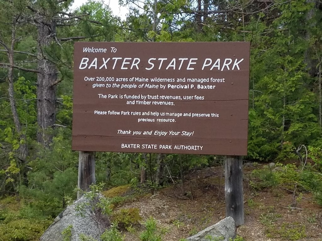
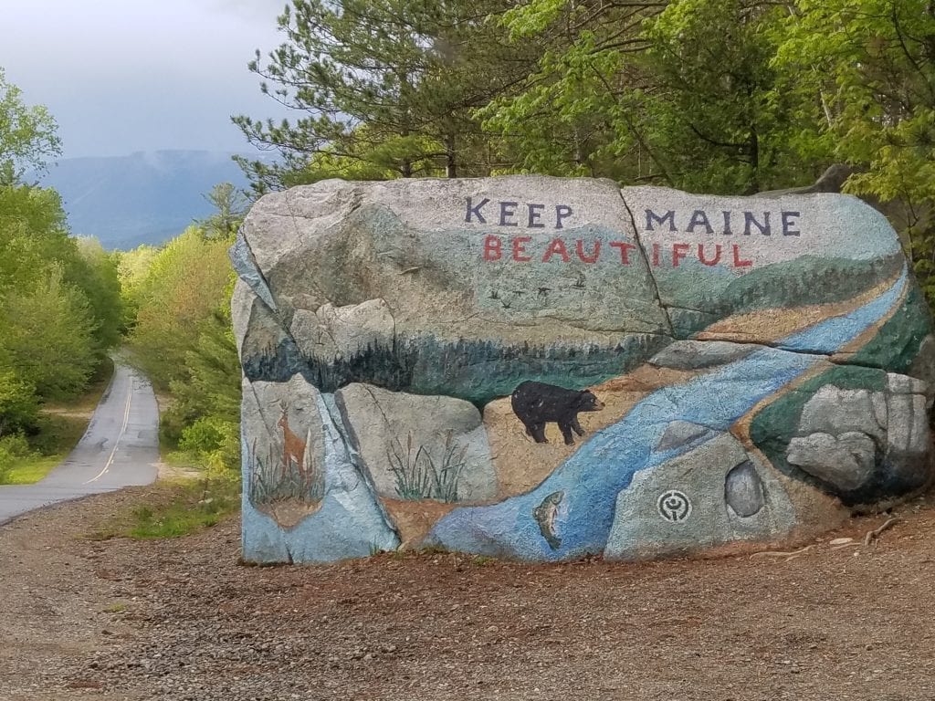
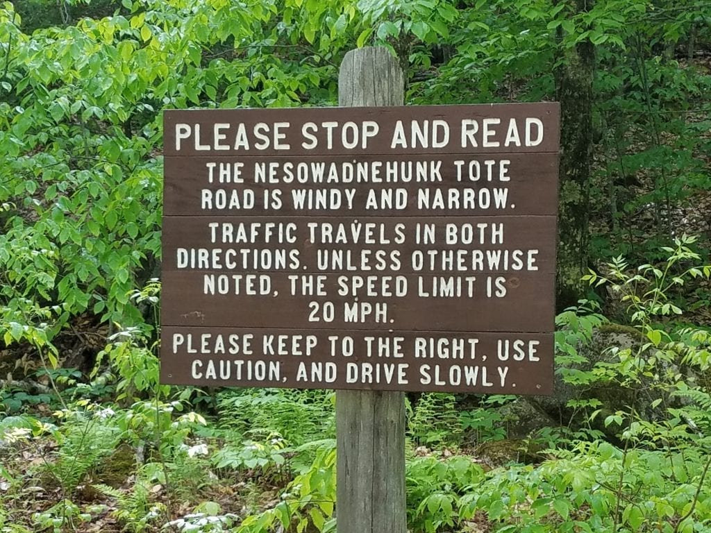
From Millinocket follow the signs for Baxter State Park. They will take you on Millinocket Lake Road, which magically becomes Baxter Park Road. It is 29 miles from Katahdin Avenue in Millinocket to Togue Pond Gatehouse. You’ll catch a few views of Katahdin along the road, and pass by the awesome “Keep Maine Beautiful” rock. This is a great opportunity to take some group photos, so long as no one is parked in front of the rock. Continue on until you reach the Togue Pond Gate. If you are a Maine resident, you don’t have to pay an entrance fee. If you aren’t a Maine resident, the fee is $15 for the day or $45 for a season pass. Stay to the left on the Park Tote Road for 7.8 miles until you see the sign for Katahdin Stream Campground on the right. There is a parking area for day hikers and a parking area for those who are staying at the campground. If you plan to camp in the park, I strongly advise calling ahead and reserving a campsite. Sites fill up fast throughout the park, and you could be out of luck and have to find a place to camp outside the park.
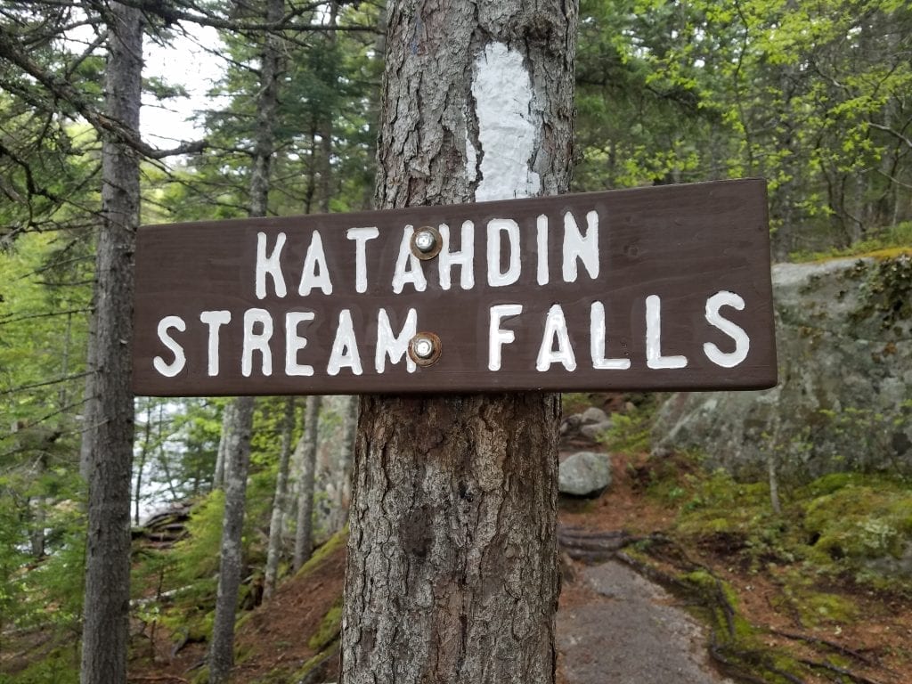
Katahdin Stream Falls Trailhead
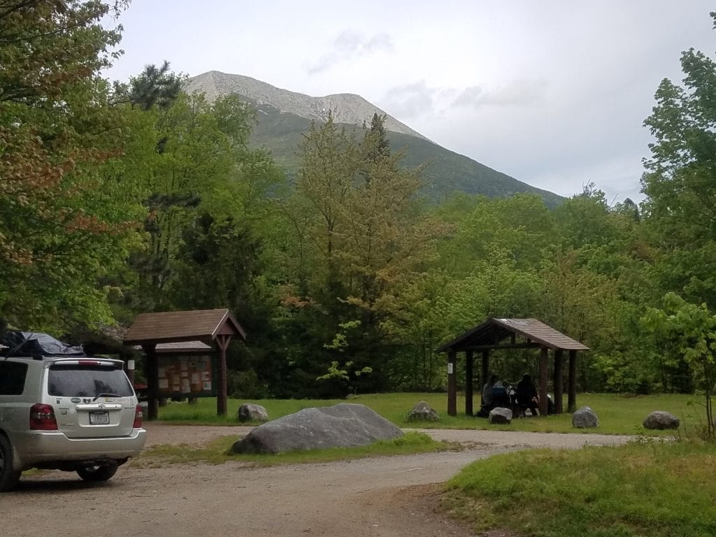
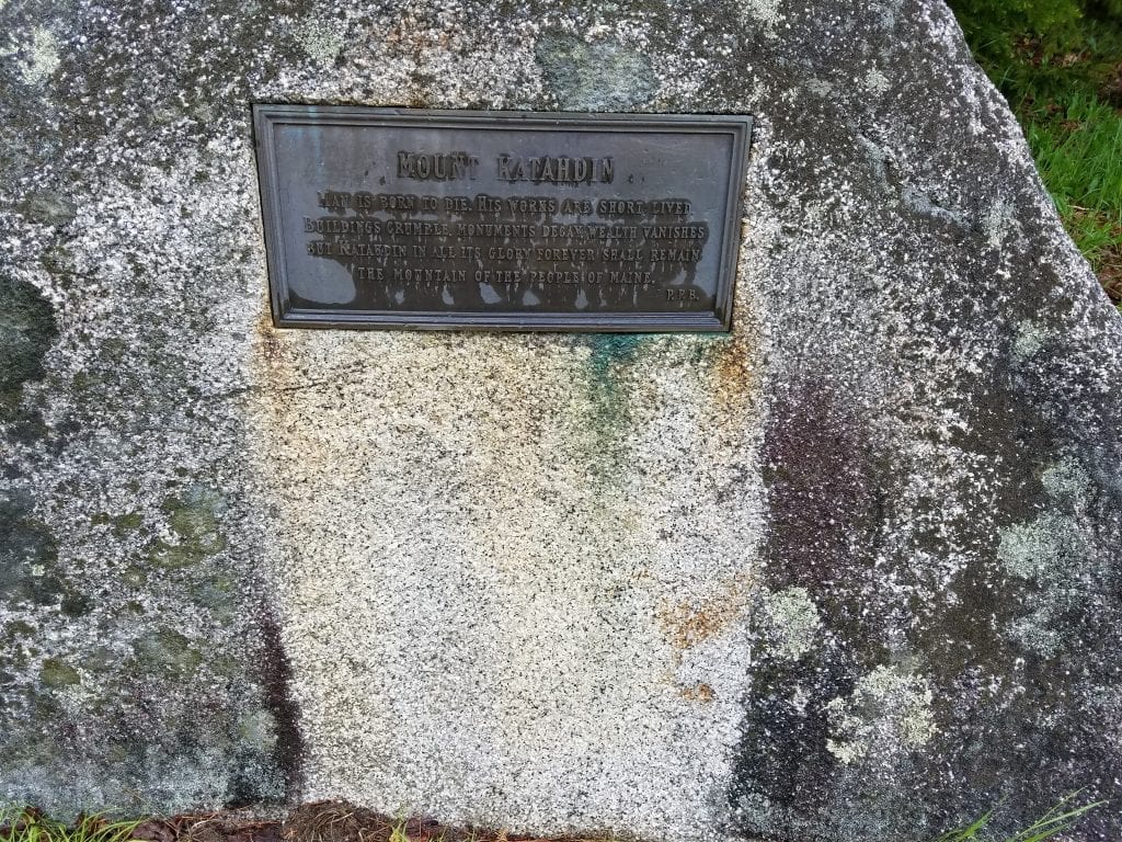
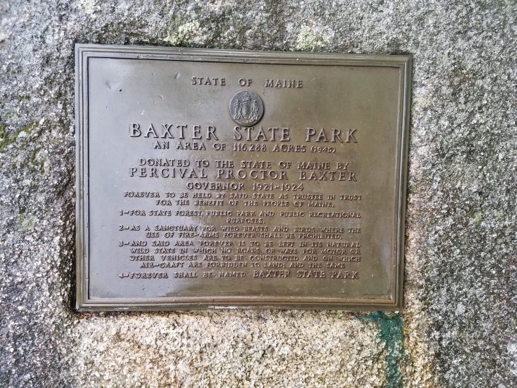
This hike is absolutely fantastic. Mount Katahdin can be seen from the Katahdin Stream Campground parking lot, depending on the weather of course. From the day hiker parking lot, the trailhead is near the large rock with plaques on it that explain the mission of Governor Baxter and Baxter State Park. The hike is 1.2 miles one-way and takes around 45 minutes to hike one-way.
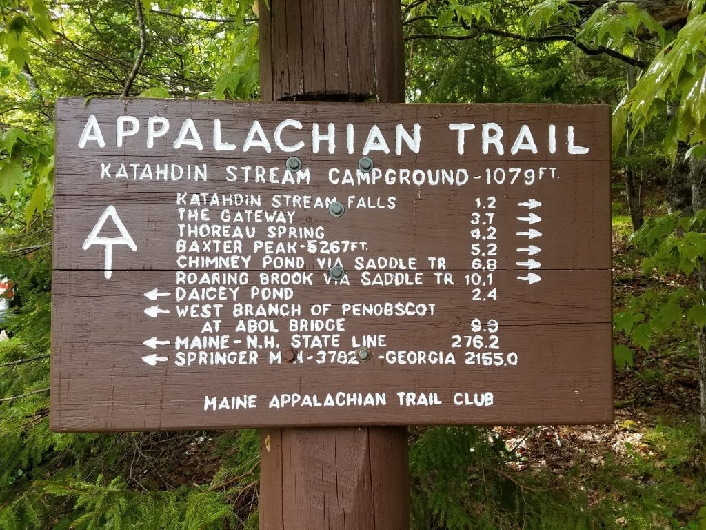
Hike to Katahdin Stream Falls on the Appalachian Trail
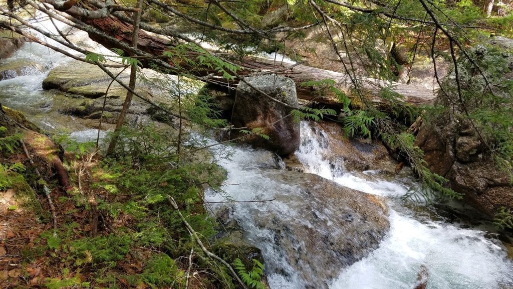
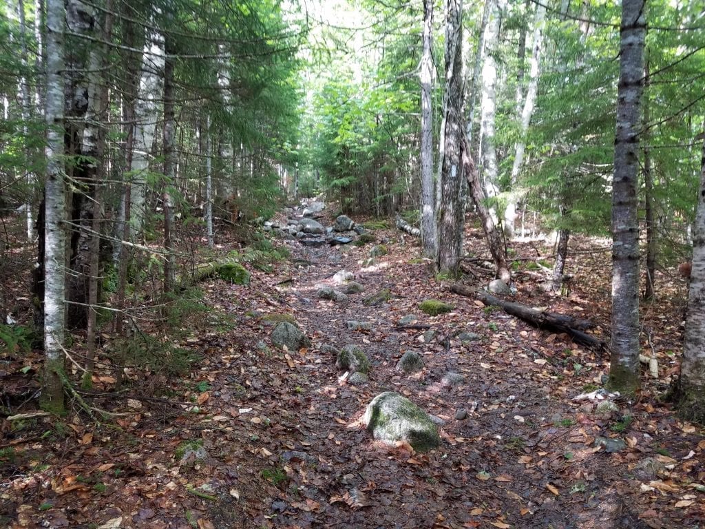
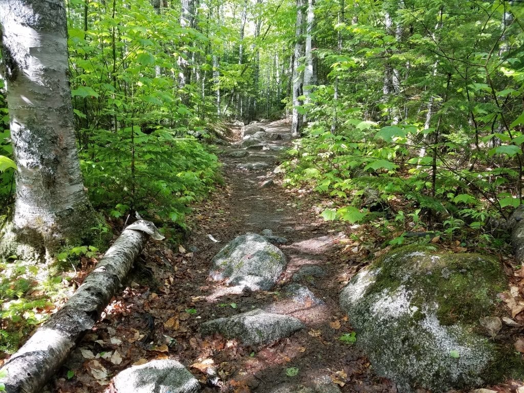
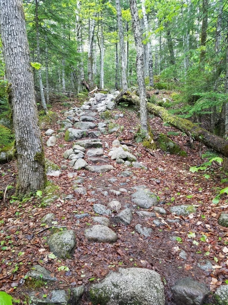
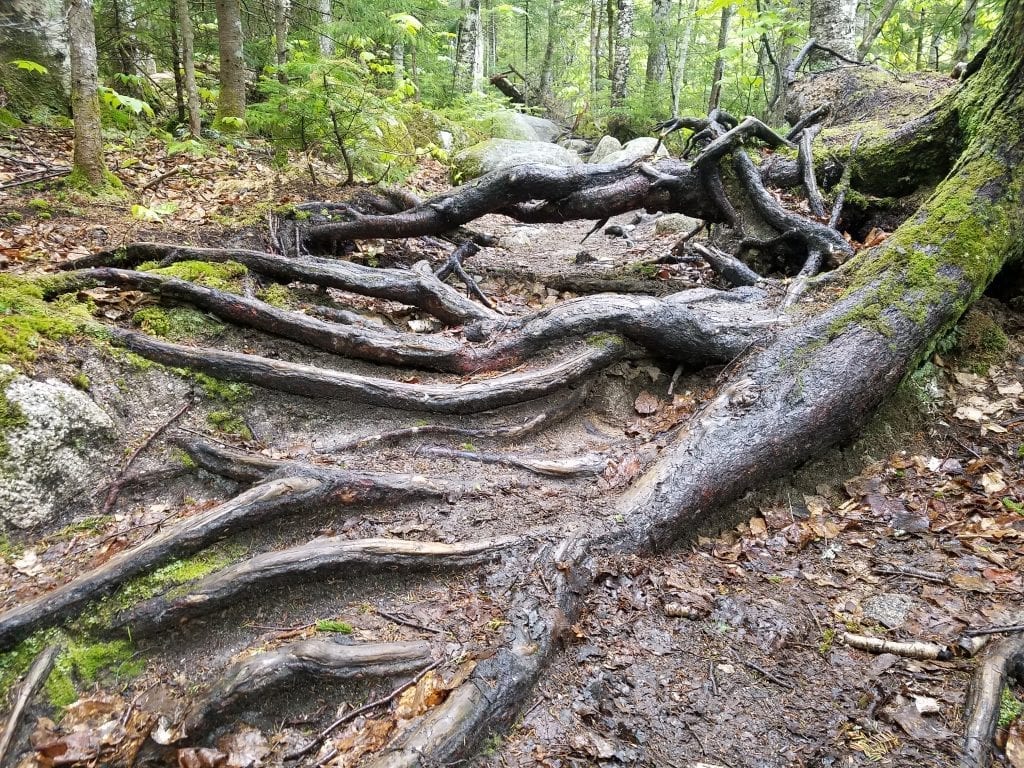
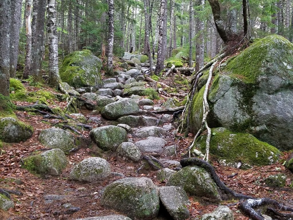
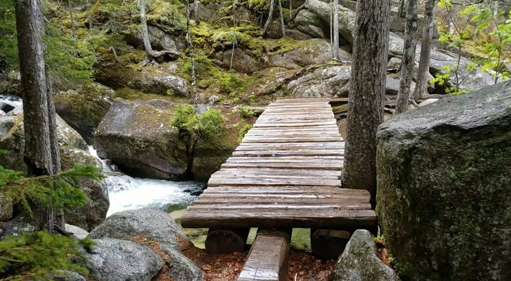
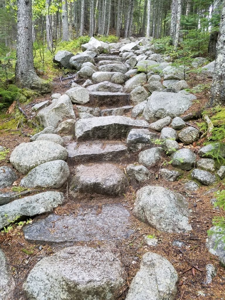
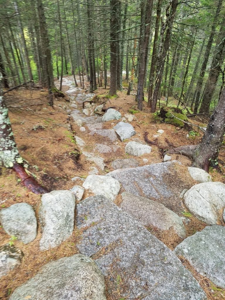
The hike to the falls follows a section of Hunt Trail on the Appalachian Trail System. The beginning of the trail is relatively easy and does eventually have a bit steeper grade, although not bad. It is a moderate grade that increased from 1,460 ft to 1,550 ft. Once you start to hear the falls, you know you’re getting close. The trail divides for abut 20 feet, and you can go either way. I stayed to the right and had to climb down between two ledges and then back up again. You come out of the woods to the stream and will see an amazing wooden bridge. You’re not there yet. Walk across the bridge and to the right, out around the boulders you’re staring at, then the trail heads sharply to the left, right behind the boulders. There is an outhouse just across the stream after you cross the bridge. Continue on for a short distance further. You’ll know when you’ve reached the falls.

Side Note
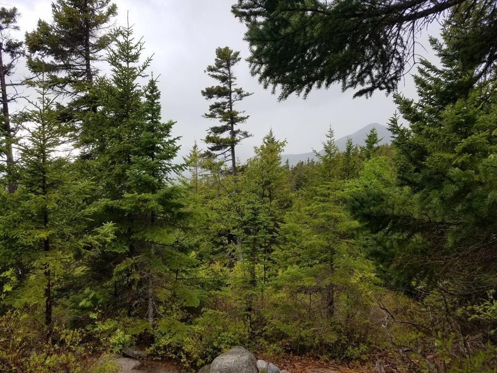
If it is a clear, beautiful day, don’t stop at the falls. Hike another 200-300 feet up the trail, up what I have named “Hell’s Staircase” (for those of us who haven’t hiked much lately), and see an amazing view of Katahdin and surrounding peaks. This section is much steeper than the trail you just hiked. I was told about this view from the Ranger at the entrance gate. Unfortunately, during my visit, it was raining and cloudy, so there wasn’t much to see, but I could envision what he was talking about. I would hike Hell’s Staircase again if the sun was out and the birds were singing for that view! If you’re exhausted by the time you reach the falls, don’t even. You’ll end up giving me hell at the end of this post later on for suggesting this extra bit of hiking if you do.
Heading Back
Be careful on the way back down the trail. If you haven’t hiked much recently (like me) your legs will be shaky, especially if you went up Hell’s Staircase to check out the view. Your legs will feel wobbly. They will shake. And shimmy. And you may even end up doing super cool breakdancing moves you didn’t know you were capable of when you slip on a patch of mud on the trail like I did. Thank Katahdin no one was around to see it! Take it easy on the way back, because going down is often much harder than going up. Just ask the Indian Trail on Mt. Kineo. Pay attention to how wet the rocks are, and remember that leaves can stick to the soles of your footwear and make you slide. Always proceed with caution. And please, don’t forget to sign in and out of the log sheet. This is how the Rangers know everyone made it back safe and they don’t need to go looking for you after dark!