

Moosehead Lake Depth Maps
Price range: $44.99 through $84.99
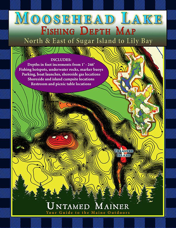
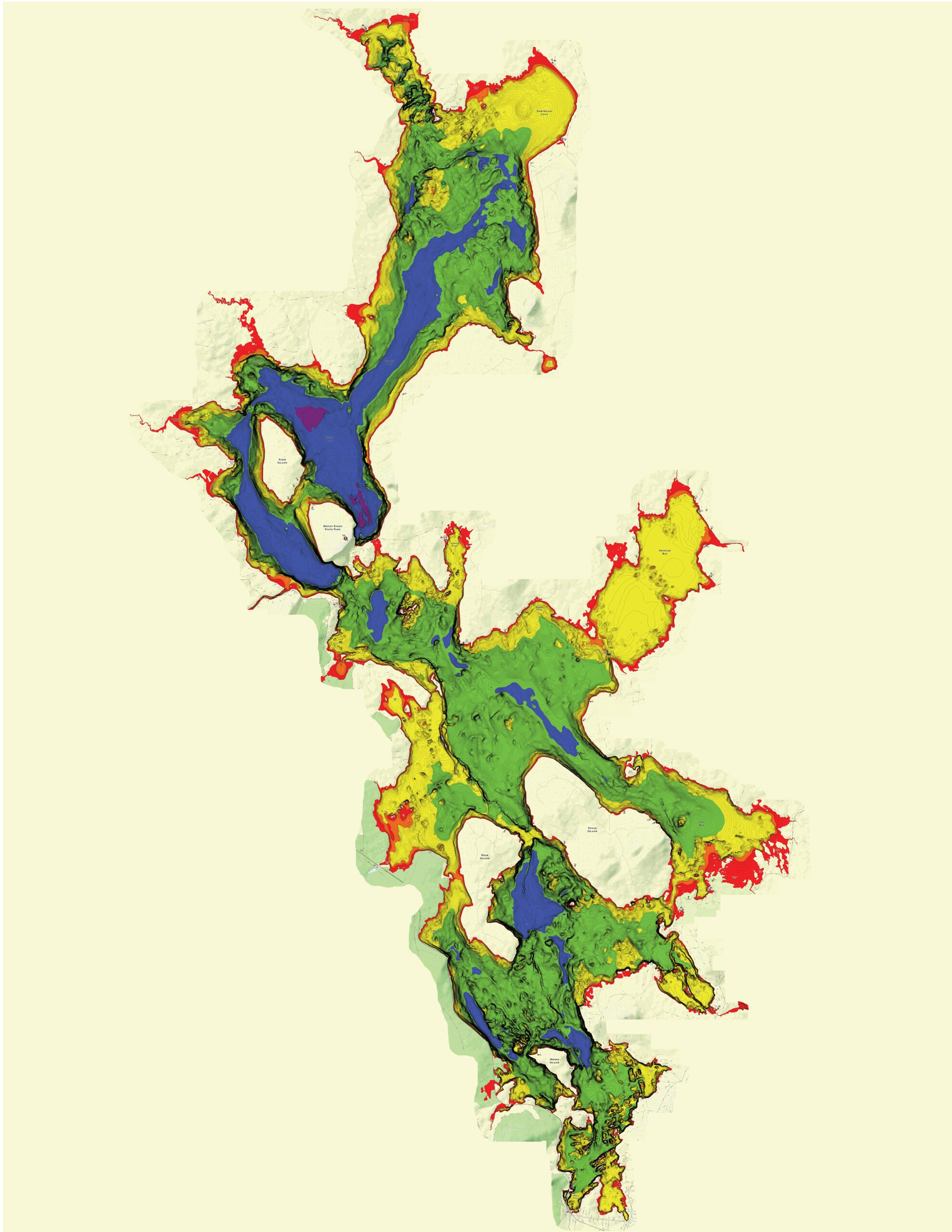
See the depths of Moosehead Lake in Full Color!
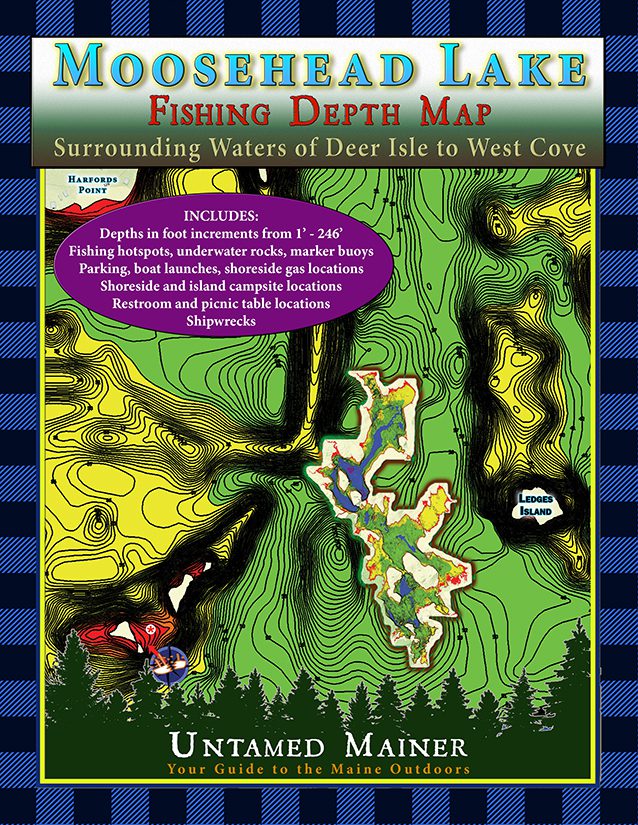
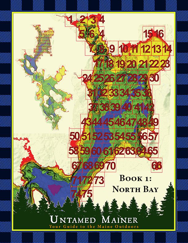
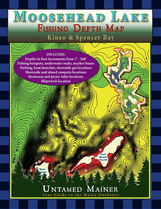
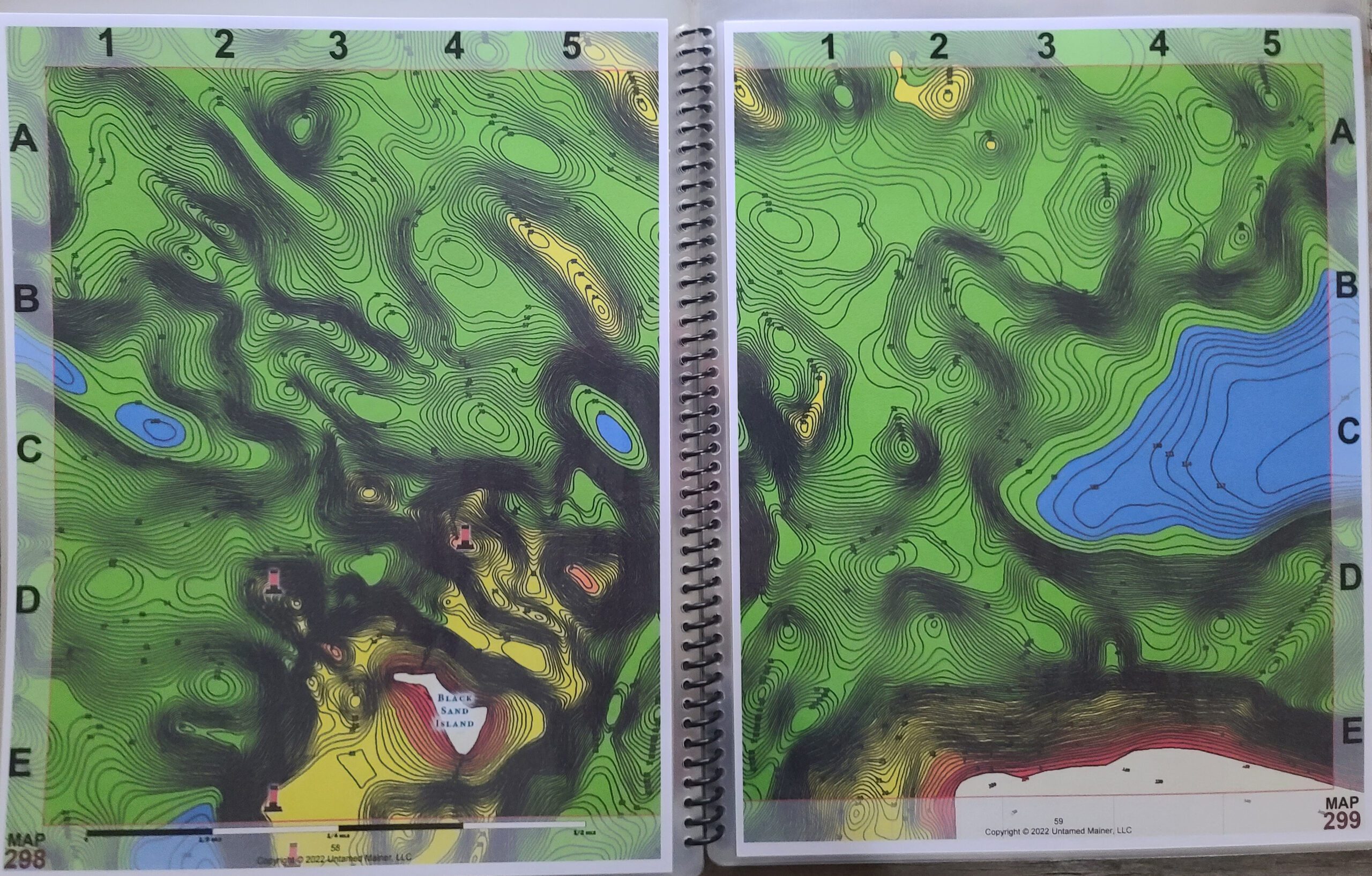
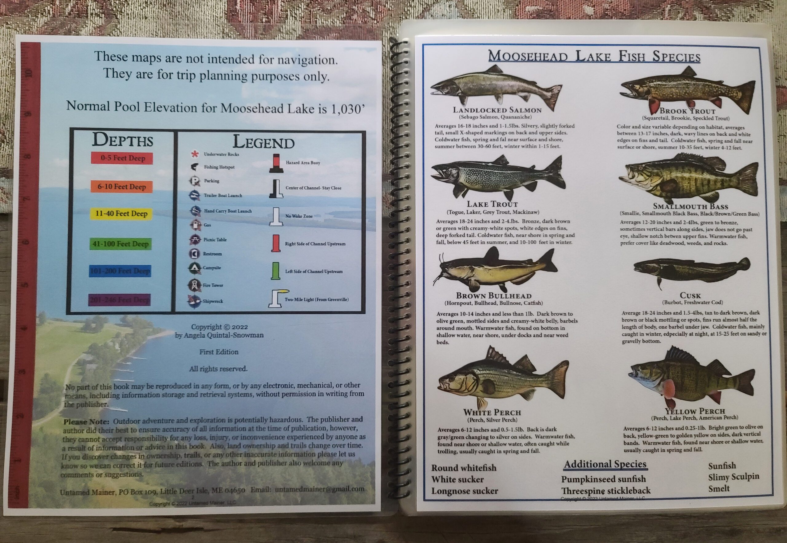
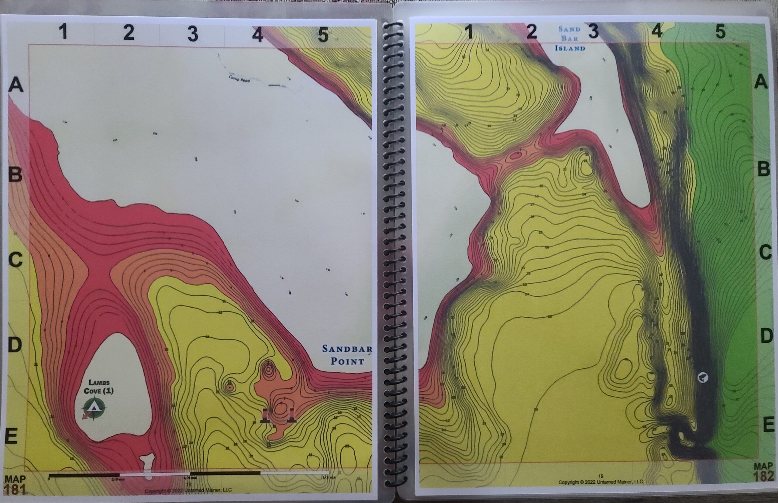
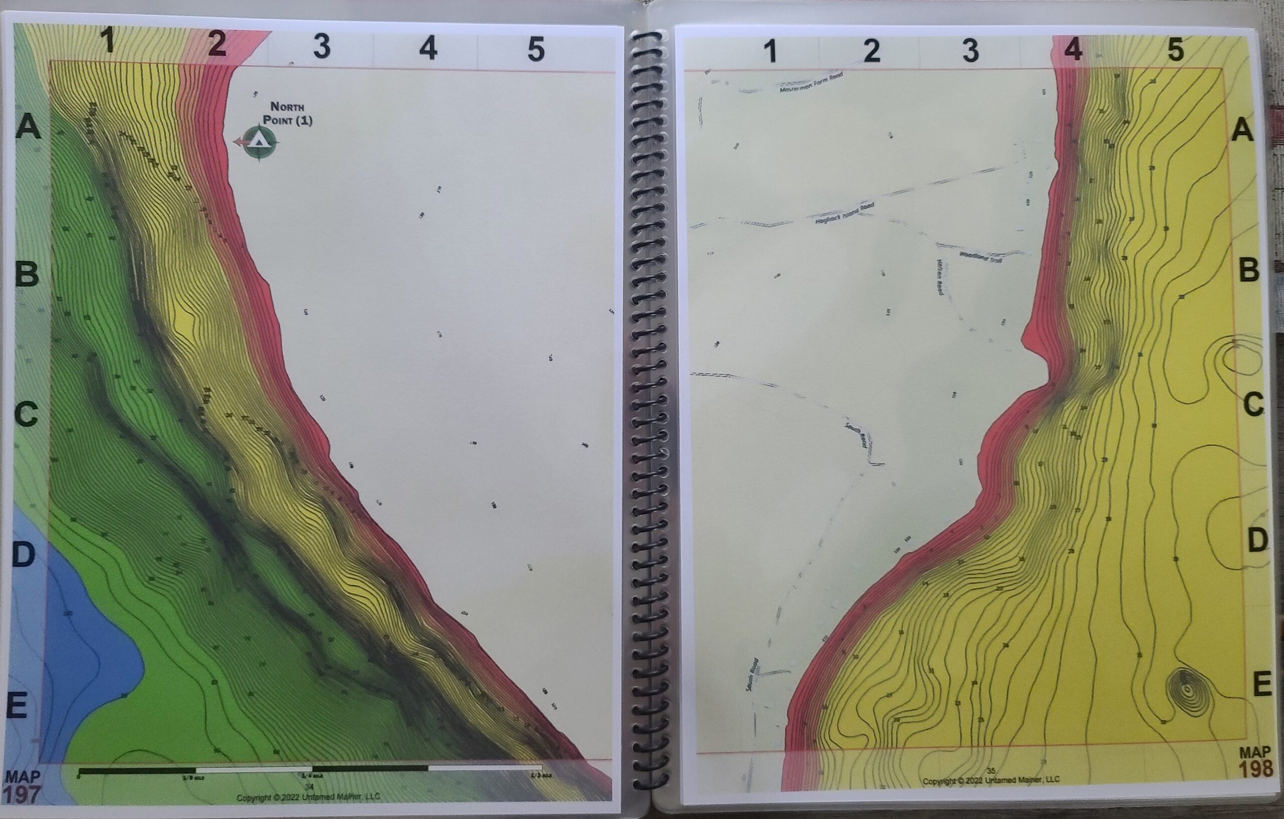
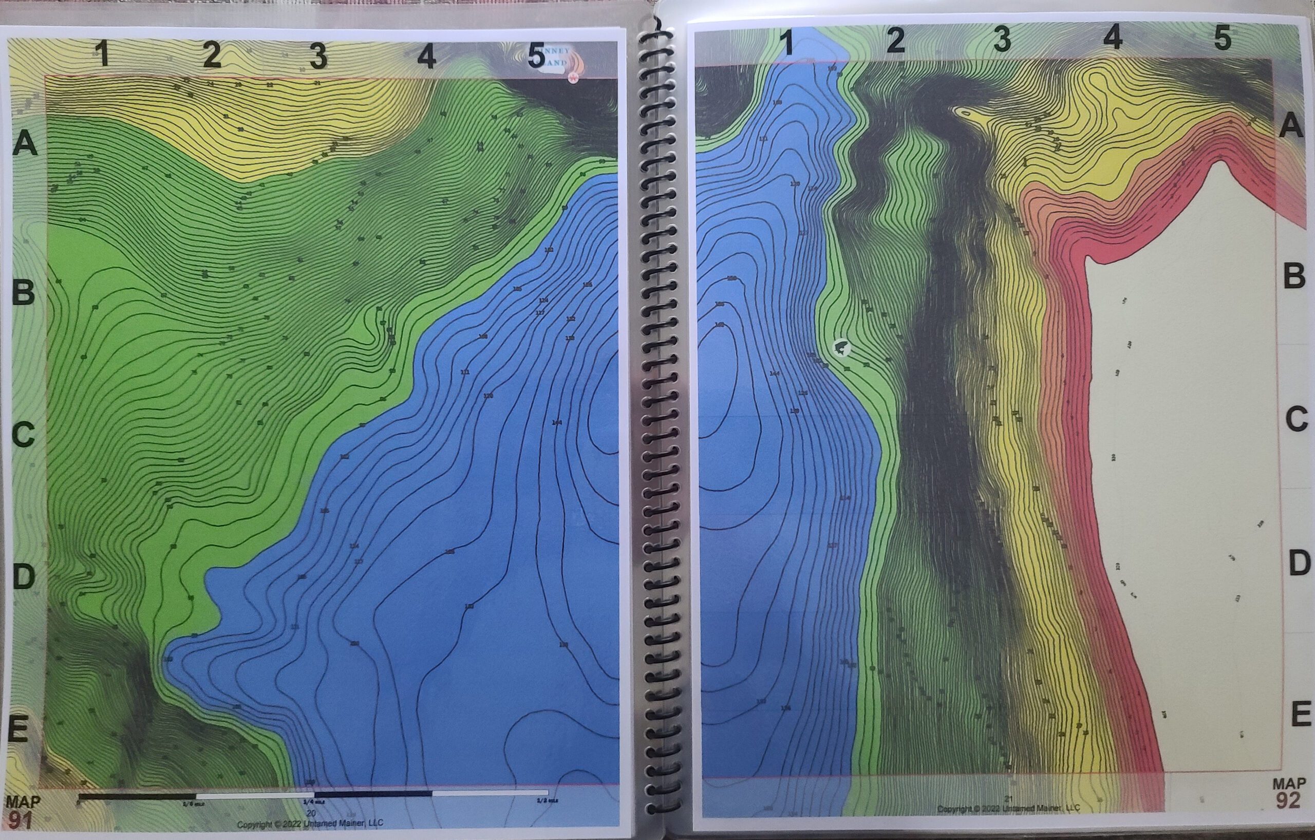
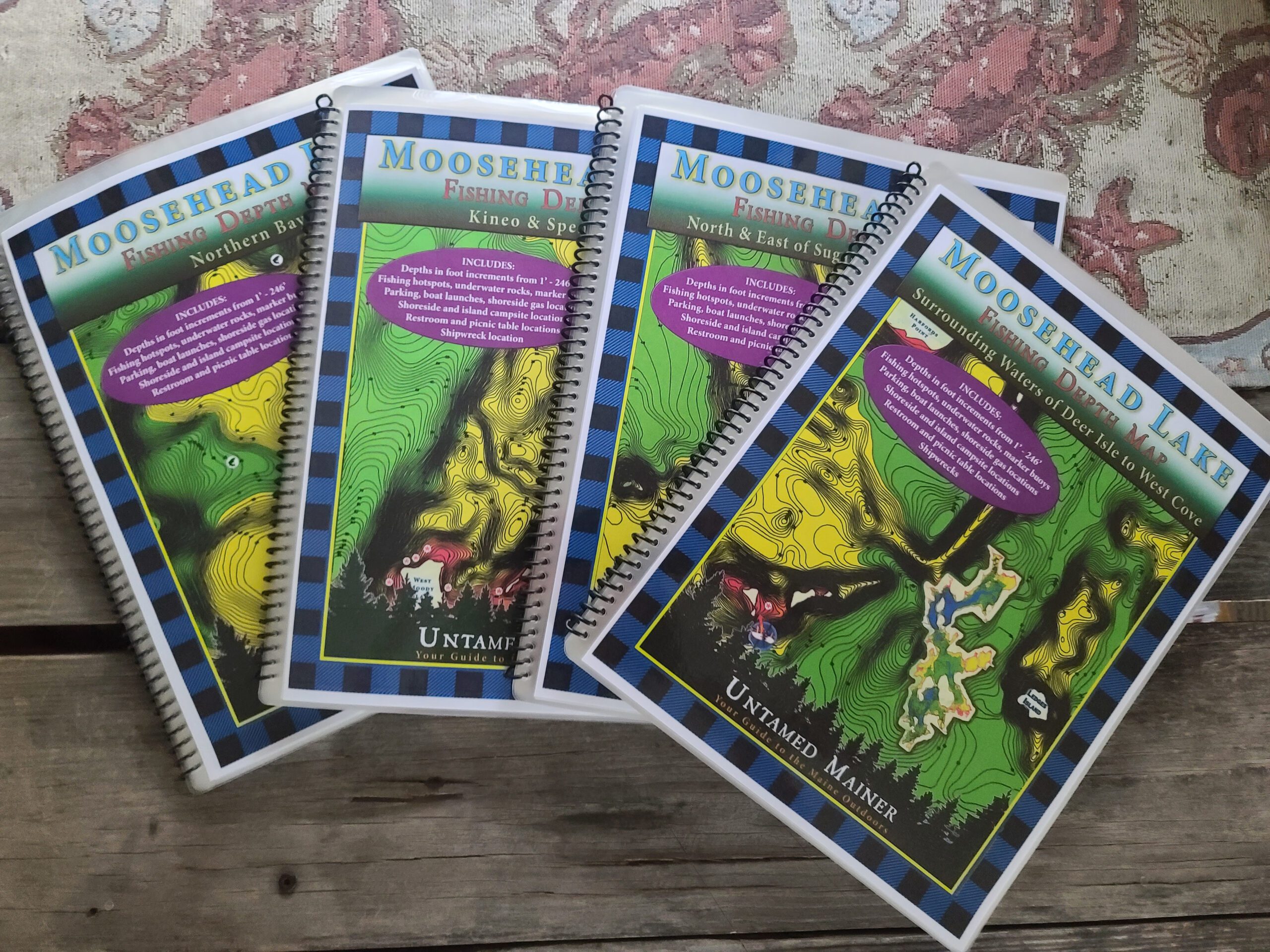
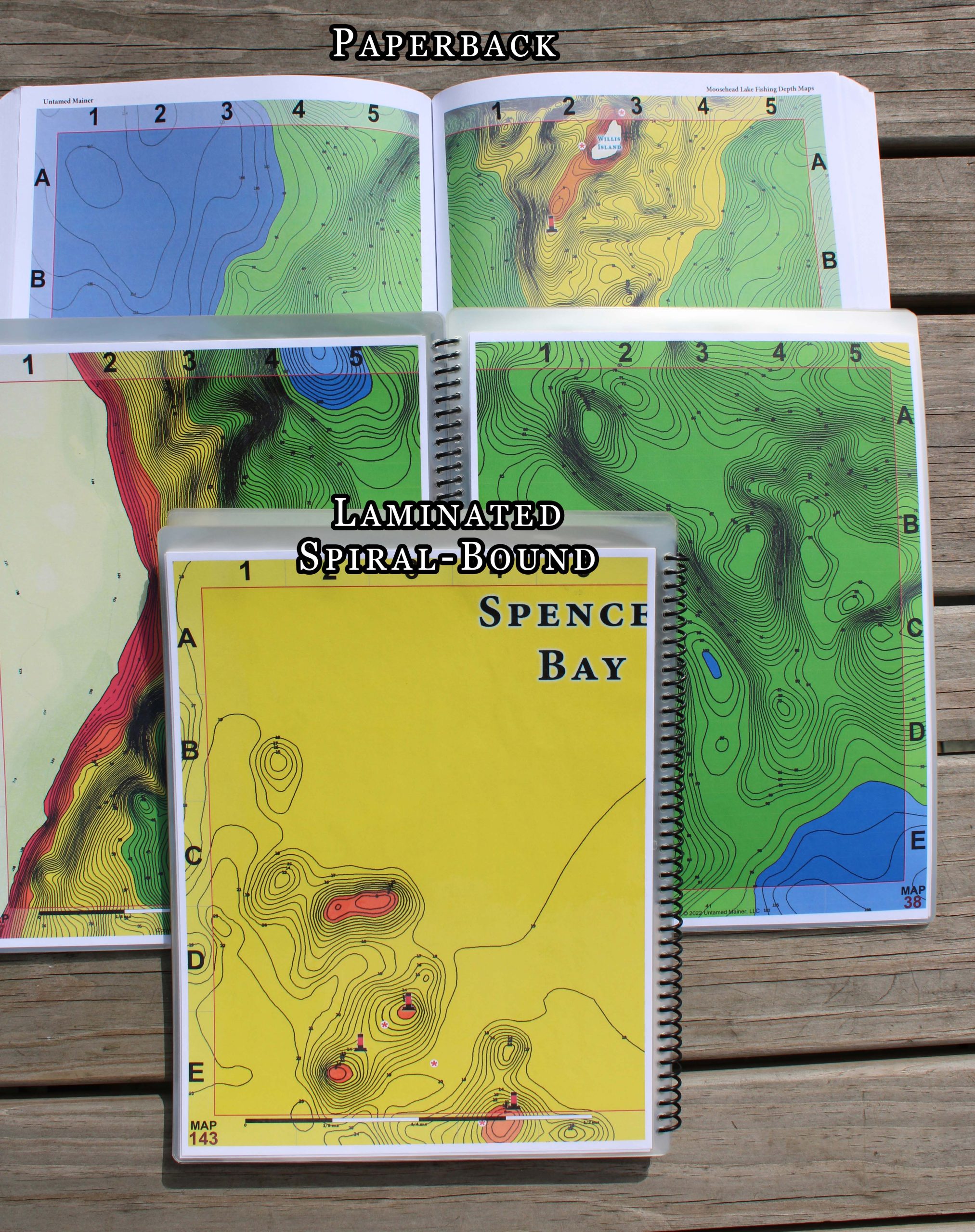
The Moosehead Lake depth maps are here! The Moosehead Lake Depth Map Atlases offer detailed 1-foot depth increments to show the contours of the bottom in full color making it easy to find drop-offs, shallow areas, deep basins, and underwater mountains. The maps include the locations of underwater rock hazards, islands, fishing hotspots, parking, trailered & hand-carry boat launches, water-accessible fuel, picnic tables, restrooms, campsites, shipwrecks (in books 2 and 4), hazard buoys, channel buoys, no-wake zones, and the two-mile light buoy. To preserve detail Moosehead Lake is divided into four separate books. Choose the book you need based on the part of the lake you’re exploring: Book 1- North Bay, Book 2– Kineo & Spencer Bay, Book 3– North & East of Sugar Island to Lily Bay, Book 4– Surrounding waters of Deer Island to West Cove. A digital download of the entire lake is available in the options menu which you can print.
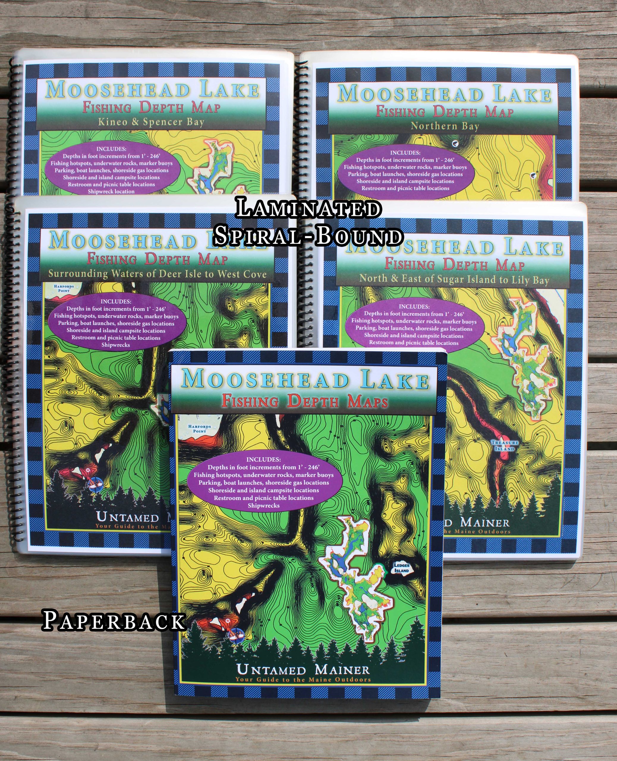
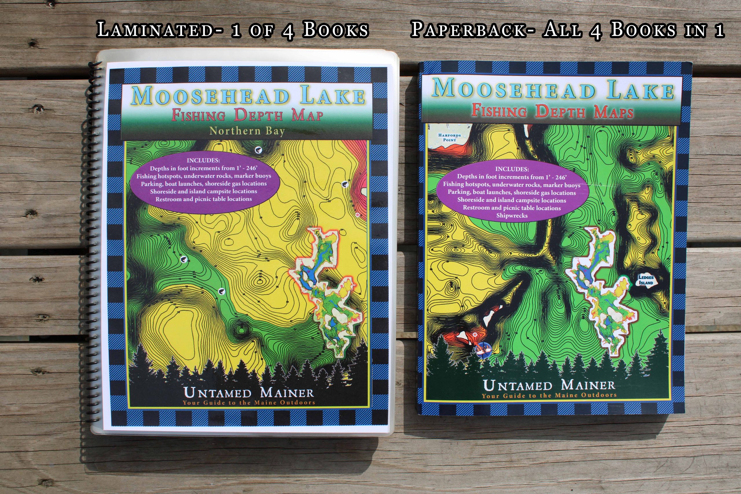
To Preserve Detail the Laminated & Not Laminated Depth Maps are Divided into Four Books:
- Book 1: North Bay (80 pages)
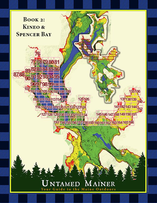
- Book 2: Kineo & Spencer Bay (96 pages)
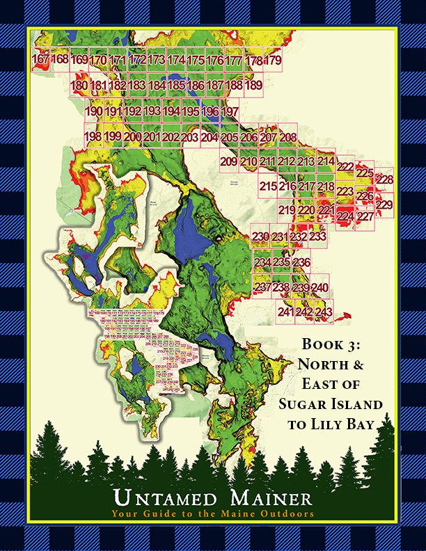
- Book 3: North & East of Sugar Island to Lily Bay (82 pages)
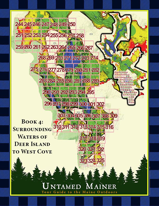
- Book 4: Surrounding Waters of Deer Island to West Cove (86 pages)
The paperback version contains all 4 of the laminated books in one (333 pages).
These maps are for trip planning purposes only and are not intended to be used for navigation.
Description
These maps are perfect if you love fishing, boating, canoeing, kayaking, camping, diving, & adventure on Moosehead Lake!
The maps include the locations of:
- Underwater rock hazards
- Fishing hotspots
- Parking
- Trailered & hand-carry boat launches
- Water-accessible fuel
- Picnic tables
- Restrooms
- Campsites
- Kineo Fire Tower
- Shipwrecks
- Hazard buoys
- Channel buoys
- No-wake zones
- Two-mile light
These maps are for trip planning purposes only and are not intended to be used for navigation.
Additional information
| Weight | 2 lbs |
|---|---|
| Dimensions | 11 × 9 × 1 in |
| Region: | Book 1: North Bay, Book 2: Kineo & Spencer Bay, Book 3: North & East of Sugar Island to Lily Bay, Book 4: Surrounding Waters of Deer Island to West Cove, Entire Map of Moosehead Lake |
| Book Type: | Laminated, Not Laminated, Paperback, .PDF Digital Download |
Related products
-

Maine’s Best Bass Fishing Lakes, Ponds, Rivers & Streams- 2026 Edition
Price range: $39.99 through $59.99 Select options This product has multiple variants. The options may be chosen on the product page -


Maine Lighthouses: Midcoast Maine Region
Price range: $28.99 through $48.99 Select options This product has multiple variants. The options may be chosen on the product page -
 Sale!
Sale!
Adventure Guide to Maine State Parks- Southern Region
Price range: $24.99 through $79.99 Select options This product has multiple variants. The options may be chosen on the product page -
 Sale!
Sale!
Die-Cut Maine Snowmobile Stickers
Price range: $3.99 through $15.99 Select options This product has multiple variants. The options may be chosen on the product page