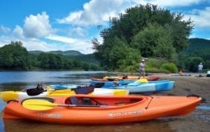
The Andsroscoggin River Canoe Trail is an ongoing project of incredible partnerships between many organizations including the state of New Hampshire, where the river trail begins. All organizations involved are currently working to establish a water trail along the full length of the Androscoggin River which traverses 168 miles. There are currently over 40 mapped public access sites to the river, and ongoing projects include improvements to portages, water access only sites, and day use areas.
The trail has three sections– The North Woods (New Hampshire section), The Mahoosucs, and The Greenway – Riverlands.
The North Woods– This is the northern-most section of the canoe trail covering the portion of the Androscoggin River located in New Hampshire. The Trail flows from the headwaters at Lake Umbagog in NH through Errol rapids, through whitewater below Pontook Dam, through the towns of Berlin and Gorham, NH, and east through Shelburne, NH to the Maine border. This section is wild, scenic, and is excellent for trout fishing and wildlife viewing.
The Mahoosucs– This section begins at the Maine border, with Gilead being the first Maine town the trail passes through. The trail passes through Bethel, Newry and Hanover with occasional fast water then reaches Rumford Falls (also known as Pennacook Falls), the largest falls east of Niagara Falls, which cascades 177 feet over granite. The trail continues east through the towns of Mexico, Dixfield, Peru, Canton, Riley, Jay, Chisholm, Livermore Falls, and Turner then reaches Androscoggin Riverlands State Park.
The Greenway – Riverlands– This section begins at the head of Gulf Island Pond and includes the Androscoggin Riverlands State Park. Much of this section includes dense woods and fields creating a remote feeling, including some islands for day use. Some islands are off-limits due to eagle nesting. The remote lands give way to the urban areas of Lewiston and Auburn then development is left behind for a faster current, some whitewater and beautiful scenery before heading through Lisbon Falls, Brunswick, Topsham and into Merrymeeting Bay, where six rivers converge into this large tidal bay, home to migrating birds and a large salmon run in the spring.
maps
The North Woods Map – The North Woods section of the Androscoggin River Canoe Trail
The Mahoosucs Map – The Mahoosucs section of the Androscoggin River Canoe Trail
The Greenway-Riverlands Map – The Androscoggin Greenway-Riverlands section of the Androscoggin River Canoe Trail
resources
NORTH WOODS (New Hampshire section of the canoe trail):
North Woods Access Sites– This document lists all access sites along the River Trail with information about launch facilities, miles to downstream access, parking, amenities, water conditions, photos and comments.
Shelburne Bridge– Located in Shelburne, NH. Information including location, launch facilities, parking, amenities, water conditions and comments.
THE MAHOOSUCS (Maine):
Mahoosucs Access Sites– This document lists all access sites along the River Trail with information about launch facilities, miles to downstream access, parking, amenities, water conditions, photos and comments.
Gilead Bridge– Information including location, launch facilities, parking, amenities, water conditions and comments.
Newts Landing– Information including location, launch facilities, parking, amenities, water conditions and comments.
ANDROSCOGGIN RIVER TRAIL GREENWAY-RIVERLANDS (Maine):
Androscoggin River Trail Greenway-Riverlands Access Sites – This document lists all access sites along the River Trail with information about launch facilities, miles to downstream access, parking, amenities, water conditions, photos and comments.